

Our alumni and students have great success in securing employment after graduation from Lakeland and securing internships while students in our program.
See where our students get internships.
As part of Lakeland's geospatial program, students are required to secure an internship where they work for 100 hours under the direction of a qualified professional in geospatial technology. Students will work in a private or public agency with a focus on geospatial technology functions, including data acquisition, management, report and map making, or other geospatial tasks.
As part of their internships, Lakeland students are given the opportunity to work on many interesting projects that showcase their talents as well as the various uses of GIS. A few of those projects are featured below.
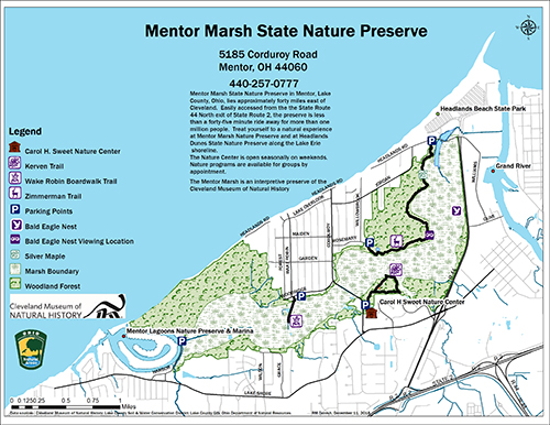
Map created by Lakeland student Rebecca Daresh during an internship project with the Cleveland Museium of Natural History
StoryMap created by Lakeland student Patricia Horkan during an internship project with the Eastern Great Lakes Region of The American Society for Photogrammetry and Remote Sensing (ASPRS)